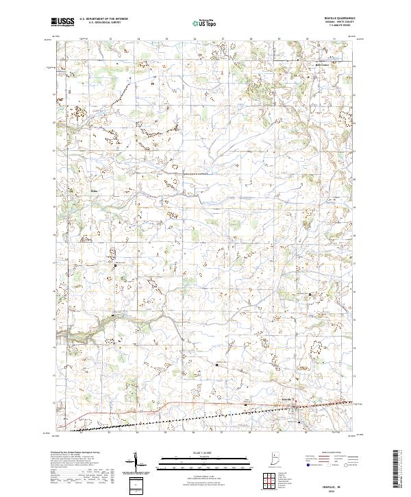
2022 Map of Idaville
USGS Topo · Published 2022About this map
Idaville and the surrounding agricultural lands of eastern White County are defined by an intricate network of drainage ditches and creeks that support this rural landscape. The settlement of Bell Center sits in the north, while Sitka occupies the western portion of this grid-iron road system. Genealogy researchers will find significant value in the high density of burial grounds throughout the area, including the centrally located Warden Cem, the western Cutler Cem, and Idaville Cem on the outskirts of its namesake town.
Find a feature on this map
46 named features on this map. Tap any name to fly to it.
Don’t see what you’re looking for? This feature index may not catch every label — zoom into the map to look around manually.
Map Details
Editions of this 2022 Idaville Map
This is the sole edition of this map. No revisions or reprints were ever made.
Other maps of this area

1953 · Danville
USGS Topo · 1:250,000

1955 · Danville
USGS Topo · 1:250,000

1956 · Danville
USGS Topo · 1:250,000

1962 · Buffalo
USGS Topo · 1:24,000

1962 · Burrows
USGS Topo · 1:24,000

1962 · Monticello South
USGS Topo · 1:24,000

1962 · Monon NE
USGS Topo · 1:24,000

1962 · Star City
USGS Topo · 1:24,000

1962 · Burnettsville
USGS Topo · 1:24,000

1962 · Monticello North
USGS Topo · 1:24,000