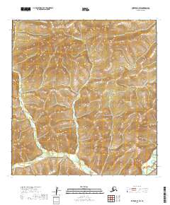
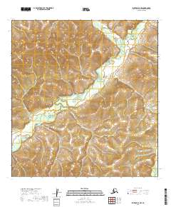
2019 Map of Iditarod B-3 SW
USGS Topo · Published 2019About this map
The George River flows through the southeastern corner of this interior Alaskan landscape, a region defined by its complex drainage network and high-relief terrain. Several major tributaries, including Doherty Cr, Barnhard Cr, and Michigan Cr, carve deep paths across the township boundaries of t26n r44w and t25n r44w. The absence of developed roads or named settlements underscores the isolation of this portion of the Yukon-Koyukuk Census Area. This map provides a detailed view of the natural watercourses, such as Starr Cr, as they move through the undulating landforms of the Iditarod region, offering a clear picture of the hydrological patterns in a wilderness largely untouched by permanent infrastructure.
Find a feature on this map
9 named features on this map. Tap any name to fly to it.
Don’t see what you’re looking for? This feature index may not catch every label — zoom into the map to look around manually.
Map Details
Editions of this 2019 Iditarod B-3 SW Map
This is the sole edition of this map. No revisions or reprints were ever made.
Other maps of this area

1951 · Iditarod
USGS Topo · 1:250,000

1954 · Iditarod A-4
USGS Topo · 1:63,360

1954 · Iditarod A-3
USGS Topo · 1:63,360

1954 · Iditarod B-3
USGS Topo · 1:63,360

1954 · Iditarod B-4
USGS Topo · 1:63,360

1956 · Iditarod
USGS Topo · 1:250,000
2019 · Iditarod B-4 SE
USGS Topo · 1:25,000
2019 · Iditarod B-3 SE
USGS Topo · 1:25,000
2019 · Iditarod B-3 NE
USGS Topo · 1:25,000
2019 · Iditarod A-3 NW
USGS Topo · 1:25,000