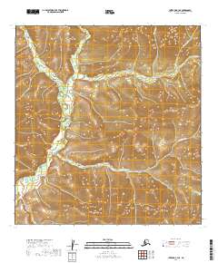
2019 Map of Iditarod B-3 SE
USGS Topo · Published 2019About this map
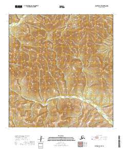
The George River winds southward through the heart of this landscape, serving as the central drainage for a series of creeks flowing from the surrounding high ground. In the northwestern corner, Beaver Cr meanders toward the main river, while Willow Cr and Bismarck Cr define the eastern drainage patterns. This 2019 survey documents the intricate topography of the Iditarod region before any modern industrial footprint, showcasing the natural hydrologic network including Little Moose Cr in the southern reaches. The arrangement of Homestake Cr and Granite Cr in the northeast suggests the typical Alaskan interior terrain where watercourses follow the folds of the land, providing a foundational record for local geography and environmental study.
Find a feature on this map
11 named features on this map. Tap any name to fly to it.
Don’t see what you’re looking for? This feature index may not catch every label — zoom into the map to look around manually.
Map Details
Editions of this 2019 Iditarod B-3 SE Map
This is the sole edition of this map. No revisions or reprints were ever made.
Other maps of this area

1951 · Iditarod
USGS Topo · 1:250,000

1954 · Iditarod B-2
USGS Topo · 1:63,360

1954 · Iditarod A-3
USGS Topo · 1:63,360

1954 · Iditarod A-2
USGS Topo · 1:63,360

1954 · Iditarod B-3
USGS Topo · 1:63,360

1956 · Iditarod
USGS Topo · 1:250,000
2019 · Iditarod B-3 NE
USGS Topo · 1:25,000
2019 · Iditarod A-3 NW
USGS Topo · 1:25,000
2019 · Iditarod B-3 SW
USGS Topo · 1:25,000
2019 · Iditarod B-3 NW
USGS Topo · 1:25,000