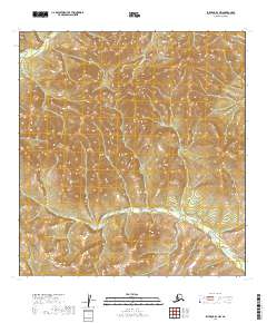
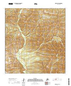
2019 Map of Iditarod B-3 NW
USGS Topo · Published 2019About this map
Kuskokwim Mountains terrain dominates this 2019 survey, where the high interior of Alaska is defined by a dense network of ridges and drainage basins. The landscape is primarily shaped by the winding course of Beaver Cr in the southern portion and the headwaters of Bonanza Cr to the north. These waterways carve through the elevations of the Yukon-Koyukuk region, illustrating the natural topographical barriers that have historically dictated movement through this interior wilderness. The map provides a precise look at the township and range divisions, such as t27n r44w, across a region where the natural hydrography remains the primary landmark for navigation and land management.
Find a feature on this map
9 named features on this map. Tap any name to fly to it.
Don’t see what you’re looking for? This feature index may not catch every label — zoom into the map to look around manually.
Map Details
Editions of this 2019 Iditarod B-3 NW Map
This is the sole edition of this map. No revisions or reprints were ever made.
Other maps of this area

1951 · Iditarod
USGS Topo · 1:250,000

1954 · Iditarod C-4
USGS Topo · 1:63,360

1954 · Iditarod C-3
USGS Topo · 1:63,360

1954 · Iditarod B-3
USGS Topo · 1:63,360

1954 · Iditarod B-4
USGS Topo · 1:63,360

1956 · Iditarod
USGS Topo · 1:250,000
2019 · Iditarod B-4 SE
USGS Topo · 1:25,000
2019 · Iditarod B-3 SE
USGS Topo · 1:25,000
2019 · Iditarod C-3 SE
USGS Topo · 1:25,000
2019 · Iditarod B-3 NE
USGS Topo · 1:25,000