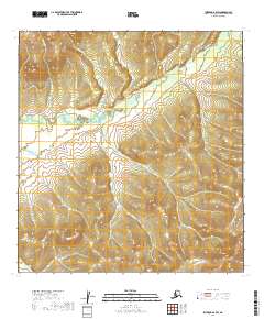
2019 Map of Iditarod B-4 SW
USGS Topo · Published 2019About this map
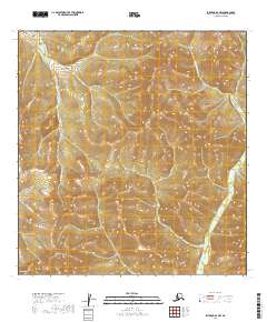
The N Fork George River and its myriad tributaries dominate this interior Alaskan landscape, which remains largely defined by its intricate drainage patterns. In the northern reaches, the terrain is carved by the winding course of Bonanza Creek and its smaller feeders like First Chance Cr and Chicken Cr. This area, part of the Yukon-Koyukuk region, exhibits the classic topographical signatures of a wilderness shaped by water, with no established roads or settlements present on the 2019 survey. The presence of Little Eldorado Cr in the southwest corner and Moose Cr to the northeast suggests a landscape still utilized primarily for resource exploration and traditional transit, maintaining the same rugged isolation that has characterized the Iditarod region for generations.
Find a feature on this map
13 named features on this map. Tap any name to fly to it.
Don’t see what you’re looking for? This feature index may not catch every label — zoom into the map to look around manually.
Map Details
Editions of this 2019 Iditarod B-4 SW Map
This is the sole edition of this map. No revisions or reprints were ever made.
Other maps of this area

1951 · Iditarod
USGS Topo · 1:250,000

1954 · Iditarod A-5
USGS Topo · 1:63,360

1954 · Iditarod A-4
USGS Topo · 1:63,360

1954 · Iditarod B-5
USGS Topo · 1:63,360

1954 · Iditarod B-4
USGS Topo · 1:63,360

1956 · Iditarod
USGS Topo · 1:250,000
2019 · Iditarod B-4 SE
USGS Topo · 1:25,000
2019 · Iditarod B-4 NW
USGS Topo · 1:25,000
2019 · Iditarod A-4 NE
USGS Topo · 1:25,000
2019 · Iditarod A-4 NW
USGS Topo · 1:25,000