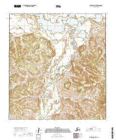
2019 Map of Iditarod D-6 NW
USGS Topo · Published 2019About this map
Netletna River defines the central drainage of this landscape in the Yukon-Koyukuk Census Area, winding through a complex system of marshes and low-lying wetlands. The terrain is characterized by a high density of small lakes and ponds, particularly in the northern reaches where the river meanders through wide alluvial flats. This 2019 survey illustrates the intricate natural hydrography of the region before it rises into the more defined topographical ridges and valleys visible to the south and west. The map provides a precise view of the Public Land Survey System grid, spanning townships including t33n r51w and t34n r50w, which helps orient the remote wilderness within the broader Alaskan interior. Without any modern roads or established settlements, the map focuses entirely on the primitive physical geography of this subarctic environment.
Find a feature on this map
10 named features on this map. Tap any name to fly to it.
Don’t see what you’re looking for? This feature index may not catch every label — zoom into the map to look around manually.
Map Details
Editions of this 2019 Iditarod D-6 NW Map
This is the sole edition of this map. No revisions or reprints were ever made.
Other maps of this area

1951 · Ophir
USGS Topo · 1:250,000

1951 · Unalakleet
USGS Topo · 1:250,000

1951 · Holy Cross
USGS Topo · 1:250,000

1951 · Iditarod
USGS Topo · 1:250,000

1952 · Unalakleet A-1
USGS Topo · 1:63,360

1952 · Holy Cross D-1
USGS Topo · 1:63,360

1952 · Unalakleet
USGS Topo · 1:250,000

1952 · Holy Cross
USGS Topo · 1:250,000

1954 · Ophir A-6
USGS Topo · 1:63,360

1954 · Iditarod D-6
USGS Topo · 1:63,360