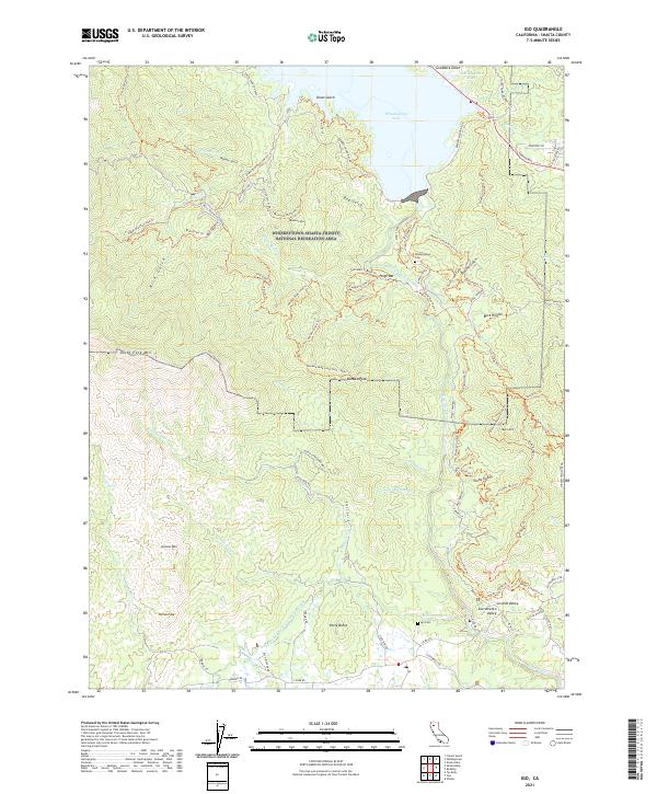
2021 Map of Igo
USGS Topo · Published 2021About this map
Whiskeytown Lake and the surrounding wilderness of the Whiskeytown-Shasta-Trinity National Recreation Area dominate this northern California landscape. This 2021 survey illustrates the complex topography where the mountains descend into the Sacramento Valley, featuring prominent peaks like Monarch Mtn and Kanaka Peak. The map provides significant detail for local historians, documenting the locations of the Whiskeytown Cem and Igo Cem, alongside historical industrial markers such as the Shasta Mine and the Happy Valley Irrigation Canal. An extensive network of trails, including the Princess Ditch Trl and Kanaka Peak Loop Trail - New Trl, reflects the region's modern transition to a primary destination for outdoor recreation while preserving the names of its mining and ranching past in places like Orofino Gulch and Buck Hollow.
Find a feature on this map
93 named features on this map. Tap any name to fly to it.
Don’t see what you’re looking for? This feature index may not catch every label — zoom into the map to look around manually.
Map Details
Editions of this 2021 Igo Map
This is the sole edition of this map. No revisions or reprints were ever made.
Other maps of this area

1890 · Red Bluff
USGS Topo · 1:250,000

1894 · Red Bluff
USGS Topo · 1:250,000

1901 · Redding
USGS Topo · 1:125,000

1913 · Weaverville
USGS Topo · 1:125,000

1932 · Olinda
USGS Topo · 1:31,680

1935 · Olinda
USGS Topo · 1:31,680

1944 · Redding
USGS Topo · 1:62,500

1944 · French Gulch
USGS Topo · 1:62,500

1946 · Redding
USGS Topo · 1:62,500

1947 · Anderson
USGS Topo · 1:62,500