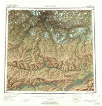
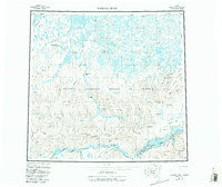
1956 Map of Ikpikpuk River
USGS Topo · Published 1960About this map
The Naval Petroleum Reserve No 4 dominates this mid-century landscape of the North Slope, revealing a region defined by cold-war era energy exploration and remote logistics. At a time when aerial photogrammetry was first detailing this wilderness, the map records the infrastructure of the search for oil, specifically noting the Oumalik Test Well, Titaluk Test Well, and Knifeblade Test Wells. These industrial outposts are linked by a network of tractor trails and winter landing areas, crossing a complex drainage system where the Ikpikpuk River and Colville River meet the Arctic coastal plain. Topographic features such as Knifeblade Ridge and Kimikpak Ridge rise above the thaw-lake plains, while evocative names like Valley of the Willows and Brontosaurus Creek hint at the observations of the surveying parties.
Find a feature on this map
49 named features on this map. Tap any name to fly to it.
Don’t see what you’re looking for? This feature index may not catch every label — zoom into the map to look around manually.
Map Details
Editions of this 1956 Ikpikpuk River Map
6 editions found

Other maps of this area

1951 · Harrison Bay
USGS Topo · 1:250,000

1951 · Meade River
USGS Topo · 1:250,000

1951 · Lookout Ridge
USGS Topo · 1:250,000

1951 · Teshekpuk
USGS Topo · 1:250,000

1951 · Ikpikpuk River
USGS Topo · 1:250,000

1951 · Chandler Lake
USGS Topo · 1:250,000

1951 · Howard Pass
USGS Topo · 1:250,000

1951 · Killik River
USGS Topo · 1:250,000

1952 · Umiat
USGS Topo · 1:250,000

1955 · Harrison Bay
USGS Topo · 1:250,000