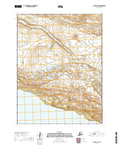
2019 Map of Iliamna A-7 SE
USGS Topo · Published 2019About this map
Katmai National Preserve encompasses much of this landscape in the Lake and Peninsula Borough, where the terrain is defined by the winding course of Nanuktuk Cr. This northern Alaskan interior region transitions from high-elevation ridgelines in the north toward the expansive waters of Nonvianuk Lake at the southern edge of the sheet. The map illustrates a wilderness mostly untouched by modern infrastructure, showing the natural drainage patterns and glacial landforms typical of the Bristol Bay drainage. Researchers can trace the survey township lines from t12s r37w to t13s r36w, which provide a geographic grid over the varied topography of marshes and hills surrounding the lake's northern shore.
Find a feature on this map
8 named features on this map. Tap any name to fly to it.
Don’t see what you’re looking for? This feature index may not catch every label — zoom into the map to look around manually.
Map Details
Editions of this 2019 Iliamna A-7 SE Map
This is the sole edition of this map. No revisions or reprints were ever made.
Other maps of this area

1948 · Mt Katmai
USGS Topo · 1:250,000

1951 · Mt Katmai
USGS Topo · 1:250,000

1951 · Mount Katmai D-5
USGS Topo · 1:63,360

1951 · Iliamna A-7
USGS Topo · 1:63,360

1951 · Mount Katmai D-4
USGS Topo · 1:63,360

1951 · Iliamna A-6
USGS Topo · 1:63,360

1952 · Iliamna
USGS Topo · 1:250,000

1957 · Iliamna
USGS Topo · 1:250,000

1964 · Mt. Katmai
USGS Topo · 1:250,000
2019 · Mount Katmai D-4 NW
USGS Topo · 1:25,000