
1951 Map of Iliamna A-7
USGS Topo · Published 1956About this map
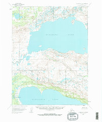
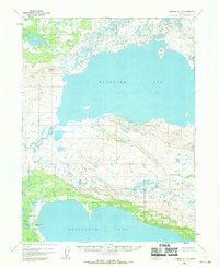
Kukaklek Lake and Nonvianuk Lake dominate this mid-century Alaskan landscape, their vast waters separated by the winding course of Nanuktuk Creek. The map shows a remote interior before significant development, where human presence is marked only by the isolated Hammersly Camp on the northern shore of Nonvianuk Lake. These glacial lakes are part of a complex hydrologic network that feeds into the Alagnak River and the Nonvianuk River, showcasing a pristine aquatic system during the early years of modern aerial mapping. This survey, based on 1951 photography, captures the drainage patterns and shoreline detail of the region's prominent lakes and braided river channels.
Find a feature on this map
6 named features on this map. Tap any name to fly to it.
Don’t see what you’re looking for? This feature index may not catch every label — zoom into the map to look around manually.
Map Details
Editions of this 1951 Iliamna A-7 Map
3 editions found
Other maps of this area

1948 · Mt Katmai
USGS Topo · 1:250,000

1951 · Mt Katmai
USGS Topo · 1:250,000

1951 · Mount Katmai D-5
USGS Topo · 1:63,360

1951 · Mount Katmai D-4
USGS Topo · 1:63,360

1951 · Iliamna A-8
USGS Topo · 1:63,360

1951 · Iliamna B-7
USGS Topo · 1:63,360

1951 · Iliamna B-6
USGS Topo · 1:63,360

1951 · Iliamna A-6
USGS Topo · 1:63,360

1952 · Iliamna
USGS Topo · 1:250,000
1952 · Iliamna A-8
USGS Topo · 1:63,360