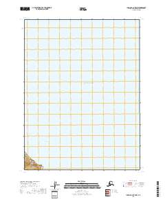
2018 Map of Iliamna B-2 OE E NW
USGS Topo · Published 2018About this map
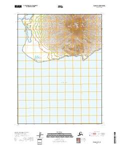
Cook Inlet and the Pacific Ocean dominate this coastal expanse along the Kenai Peninsula. The maritime landscape is defined by the open waters of the inlet, while the land is organized by the Public Land Survey System within T9s R24w. The terrestrial portion of the map is located in the southwestern corner, showing the coastal interface where the shoreline meets the sea. This 2018 survey serves as a precise record of the shoreline and maritime boundaries before further environmental shifts, providing a clear view of the township and range divisions that define land ownership and management in this part of Alaska.
Find a feature on this map
23 named features on this map. Tap any name to fly to it.
Don’t see what you’re looking for? This feature index may not catch every label — zoom into the map to look around manually.
Map Details
Editions of this 2018 Iliamna B-2 OE E NW Map
This is the sole edition of this map. No revisions or reprints were ever made.
Other maps of this area

1949 · Iliamna C-1
USGS Topo · 1:63,360

1952 · Iliamna
USGS Topo · 1:250,000

1957 · Iliamna
USGS Topo · 1:250,000

1958 · Iliamna C-2
USGS Topo · 1:63,360

1958 · Iliamna B-2
USGS Topo · 1:63,360

1958 · Iliamna C-1
USGS Topo · 1:63,360
2018 · Iliamna B-2 OE E SW
USGS Topo · 1:25,000
2018 · Iliamna B-2 NE
USGS Topo · 1:25,000
2018 · Iliamna C-1 SW
USGS Topo · 1:25,000
2018 · Iliamna B-2 SE
USGS Topo · 1:25,000