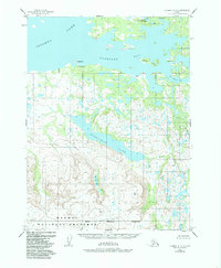
1954 Map of Iliamna B-5
USGS Topo · Published 1985About this map
Kakhonak sits on the southern shore of Iliamna Lake, serving as a focal point for aviation and water travel in this portion of the Kenai Peninsula Borough. Topography from the early 1950s reveals a landscape defined by the intersection of freshwater systems and mountainous terrain, with a Landing Strip supporting the small settlement's connectivity. To the south, the boundary of the Katmai National Preserve encompasses the high country above Emerald Lake. The map details the intricate shoreline of Kakhonak Bay, reaching past Reindeer Island and into more sheltered waters like Snug Hbr. Inland, Gibraltar Lake and Dream Creek illustrate the drainage patterns that dominate the interior, where scattered Cabins mark the only other signs of human presence in this expanse of the Alaska Peninsula.
Find a feature on this map
17 named features on this map. Tap any name to fly to it.
Don’t see what you’re looking for? This feature index may not catch every label — zoom into the map to look around manually.
Map Details
Editions of this 1954 Iliamna B-5 Map
2 editions found
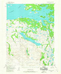
Other maps of this area

1951 · Iliamna A-5
USGS Topo · 1:63,360

1951 · Iliamna A-4
USGS Topo · 1:63,360

1951 · Iliamna B-5
USGS Topo · 1:63,360

1951 · Iliamna B-6
USGS Topo · 1:63,360

1951 · Iliamna A-6
USGS Topo · 1:63,360

1952 · Iliamna
USGS Topo · 1:250,000

1952 · Iliamna A-4
USGS Topo · 1:63,360

1952 · Iliamna A-5
USGS Topo · 1:63,360

1954 · Iliamna C-6
USGS Topo · 1:63,360

1954 · Iliamna C-5
USGS Topo · 1:63,360