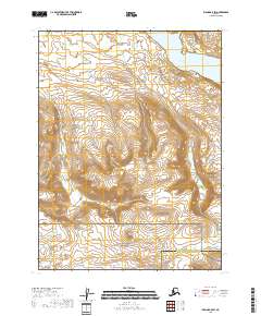
2018 Map of Iliamna B-5 SW
USGS Topo · Published 2018About this map
Katmai National Preserve occupies the southern reaches of this landscape, marking a transition into protected wilderness within the Lake and Peninsula Borough. The terrain is defined by dramatic elevation changes, with numerous unnamed peaks and ridges surrounding the basin of Gibraltar Lake in the northeastern corner. This freshwater body sits at the foot of steep slopes, serving as a primary hydrological feature in an area otherwise characterized by high-altitude glacial valleys and tundra. The map also delineates the administrative boundary with the Kenai Peninsula Borough, illustrating how these massive jurisdictional lines overlay the remote Alagnak River watershed region. Without roads or permanent settlements, the map focuses on the raw topography and the legal boundaries of the preserve, essential for understanding land management in the Alaska Peninsula's interior.
Find a feature on this map
9 named features on this map. Tap any name to fly to it.
Don’t see what you’re looking for? This feature index may not catch every label — zoom into the map to look around manually.
Map Details
Editions of this 2018 Iliamna B-5 SW Map
This is the sole edition of this map. No revisions or reprints were ever made.
Other maps of this area

1951 · Iliamna A-5
USGS Topo · 1:63,360

1951 · Iliamna B-5
USGS Topo · 1:63,360

1951 · Iliamna B-6
USGS Topo · 1:63,360

1951 · Iliamna A-6
USGS Topo · 1:63,360

1952 · Iliamna
USGS Topo · 1:250,000

1952 · Iliamna A-5
USGS Topo · 1:63,360
1954 · Iliamna B-5
USGS Topo · 1:63,360
1954 · Iliamna B-6
USGS Topo · 1:63,360

1957 · Iliamna
USGS Topo · 1:250,000
2018 · Iliamna A-5 NW
USGS Topo · 1:25,000