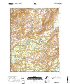
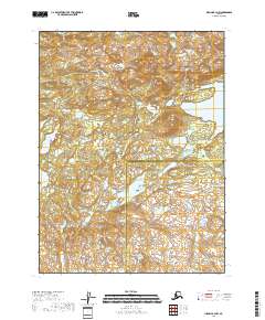
2018 Map of Iliamna C-4 SE
USGS Topo · Published 2018About this map
Tommy Cr flows through the northwestern corner of this remote Alaskan terrain, where the landscape is defined by the complex hydrology of the Lake and Peninsula Borough. The presence of numerous unnamed lakes and intricate drainage patterns suggests a highly saturated environment typical of this part of the Bristol Bay watershed. These features point to a wild, unpopulated territory where the land remains largely untransformed by permanent settlements or transportation infrastructure, providing a primary record of the natural topography as it existed in 2018.
Find a feature on this map
1 named feature on this map. Tap any name to fly to it.
Don’t see what you’re looking for? This feature index may not catch every label — zoom into the map to look around manually.
Map Details
Editions of this 2018 Iliamna C-4 SE Map
This is the sole edition of this map. No revisions or reprints were ever made.
Other maps of this area

1952 · Iliamna
USGS Topo · 1:250,000

1954 · Iliamna C-3
USGS Topo · 1:63,360

1954 · Iliamna B-3
USGS Topo · 1:63,360

1954 · Iliamna C-4
USGS Topo · 1:63,360

1954 · Iliamna B-4
USGS Topo · 1:63,360

1957 · Iliamna
USGS Topo · 1:250,000
2018 · Iliamna C-4 NE
USGS Topo · 1:25,000
2018 · Iliamna B-4 NE
USGS Topo · 1:25,000
2018 · Iliamna C-3 NW
USGS Topo · 1:25,000
2018 · Iliamna B-4 NW
USGS Topo · 1:25,000