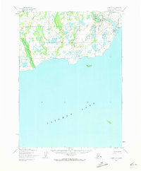
1954 Map of Iliamna C-6
USGS Topo · Published 1973About this map
The settlement of Newhalen sits at the northern edge of Iliamna Lake, marking a vital point of contact between the vast freshwater basin and the Newhalen River. This mid-century survey captures a landscape defined by its waterways and emerging infrastructure, including the Iliamna Airfield positioned near the river's mouth. The terrain is characterized by a dense network of marshes and streams, notably Upper Talarik Creek and Talarik Creek to the west, which drain into the lake's northern shore.
Find a feature on this map
9 named features on this map. Tap any name to fly to it.
Don’t see what you’re looking for? This feature index may not catch every label — zoom into the map to look around manually.
Map Details
Editions of this 1954 Iliamna C-6 Map
2 editions found
Other maps of this area

1951 · Iliamna B-5
USGS Topo · 1:63,360

1951 · Iliamna B-7
USGS Topo · 1:63,360

1951 · Iliamna B-6
USGS Topo · 1:63,360

1952 · Iliamna
USGS Topo · 1:250,000

1954 · Iliamna C-6
USGS Topo · 1:63,360

1954 · Iliamna C-5
USGS Topo · 1:63,360

1954 · Iliamna D-5
USGS Topo · 1:63,360
1954 · Iliamna B-5
USGS Topo · 1:63,360
1954 · Iliamna B-6
USGS Topo · 1:63,360
1954 · Iliamna C-7
USGS Topo · 1:63,360