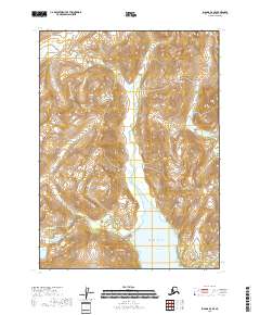
2018 Map of Iliamna D-2 SE
USGS Topo · Published 2018About this map
Chigmit Mountains dominate the western landscape of this coastal region, where high peaks drop toward the waters of the Pacific Ocean. The topography is defined by the sharp elevations of Roscoe Peak and Sugarloaf Mtn, with the Roscoe Glacier serving as a significant ice feature feeding into the local drainage system. This 2018 survey illustrates the complex intersection of glacial runoff and tidal influence along the northern reaches of Iniskin Bay.
Find a feature on this map
16 named features on this map. Tap any name to fly to it.
Don’t see what you’re looking for? This feature index may not catch every label — zoom into the map to look around manually.
Map Details
Editions of this 2018 Iliamna D-2 SE Map
This is the sole edition of this map. No revisions or reprints were ever made.
Other maps of this area

1949 · Iliamna C-1
USGS Topo · 1:63,360

1952 · Iliamna
USGS Topo · 1:250,000

1957 · Iliamna
USGS Topo · 1:250,000

1958 · Iliamna D-2
USGS Topo · 1:63,360

1958 · Iliamna C-2
USGS Topo · 1:63,360

1958 · Iliamna D-1
USGS Topo · 1:63,360

1958 · Iliamna C-1
USGS Topo · 1:63,360
2018 · Iliamna D-1 SW
USGS Topo · 1:25,000
2018 · Iliamna C-2 NE
USGS Topo · 1:25,000
2018 · Iliamna D-2 NE
USGS Topo · 1:25,000