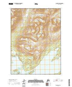
2018 Map of Iliamna D-3 SW
USGS Topo · Published 2018About this map
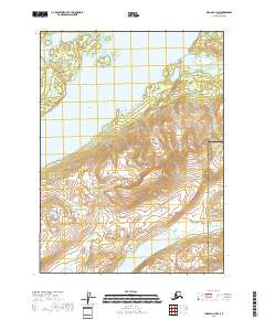
Pedro Bay sits on the northern shores of Iliamna Lake, serving as a critical point of access for this portion of the Lake and Peninsula Borough. The landscape is defined by the transition from the high elevations surrounding Knutson Valley down to the complex coastline of the lake. Transportation in this remote area is anchored by the Pedro Bay Airport, which connects to the settlement via Airport Road and Bay Road. These few corridors represent the primary human imprint on a terrain otherwise dominated by significant water features and islands.
Find a feature on this map
21 named features on this map. Tap any name to fly to it.
Don’t see what you’re looking for? This feature index may not catch every label — zoom into the map to look around manually.
Map Details
Editions of this 2018 Iliamna D-3 SW Map
This is the sole edition of this map. No revisions or reprints were ever made.
Other maps of this area

1952 · Iliamna
USGS Topo · 1:250,000

1954 · Iliamna D-3
USGS Topo · 1:63,360

1954 · Iliamna D-4
USGS Topo · 1:63,360

1954 · Iliamna C-3
USGS Topo · 1:63,360

1954 · Iliamna C-4
USGS Topo · 1:63,360

1957 · Iliamna
USGS Topo · 1:250,000
2018 · Iliamna C-4 NE
USGS Topo · 1:25,000
2018 · Iliamna D-3 SE
USGS Topo · 1:25,000
2018 · Iliamna C-3 NE
USGS Topo · 1:25,000
2018 · Iliamna C-3 NW
USGS Topo · 1:25,000