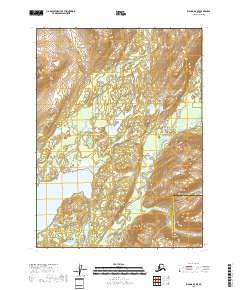
2018 Map of Iliamna D-3 SE
USGS Topo · Published 2018About this map
Iliamna Lake anchors this corner of the Alaska Peninsula, where the landscape is defined by the drainage systems of the Pile River and the Iliamna River. This 2018 survey reveals a territory of significant transition, situated along the jurisdictional boundary of the Lake and Peninsula Borough Kenai Peninsula Borough. The presence of the Williamsport-Pile Bay Road indicates a vital portage corridor, connecting the northern reach of the largest lake in Alaska to the coastal waters of Cook Inlet to the east. Between the major river valleys, the terrain is dotted with smaller water bodies such as Long Lake, illustrating the complex glacial geography of the region. This map is an essential reference for understanding the modern infrastructure and natural boundaries in a remote area where transportation is governed by narrow overland routes and massive inland waterways.
Find a feature on this map
12 named features on this map. Tap any name to fly to it.
Don’t see what you’re looking for? This feature index may not catch every label — zoom into the map to look around manually.
Map Details
Editions of this 2018 Iliamna D-3 SE Map
This is the sole edition of this map. No revisions or reprints were ever made.
Other maps of this area

1952 · Iliamna
USGS Topo · 1:250,000

1954 · Iliamna D-3
USGS Topo · 1:63,360

1954 · Iliamna C-3
USGS Topo · 1:63,360

1957 · Iliamna
USGS Topo · 1:250,000

1958 · Iliamna D-2
USGS Topo · 1:63,360

1958 · Iliamna C-2
USGS Topo · 1:63,360
2018 · Iliamna C-3 NE
USGS Topo · 1:25,000
2018 · Iliamna C-3 NW
USGS Topo · 1:25,000

2018 · Iliamna D-2 SW
USGS Topo · 1:25,000
2018 · Iliamna D-3 SW
USGS Topo · 1:25,000