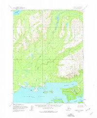
1954 Map of Iliamna D-4
USGS Topo · Published 1974About this map
The settlement of Chekok sits at the head of Chekok Bay in this mid-century survey of the northern reaches of Iliamna Lake. The landscape is defined by the massive presence of Knutson Mountain and Pedro Mountain, which rise sharply above the intricate coastline. This area, mapped from aerial photography in the 1950s, reveals a complex network of waterways, including the winding course of Chekok Creek and the sheltered waters of Knutson Bay. To the north, the terrain transitions into deep-set valleys like the Canyon and alpine water bodies such as Lower Tazimina Lake and Chekok Lake. Offshore, prominent landmarks like Chekok Point, Hat Island, and Porcupine Island provide essential navigation references for the deep inlets and bays that characterize this part of the Alaska Peninsula.
Find a feature on this map
18 named features on this map. Tap any name to fly to it.
Don’t see what you’re looking for? This feature index may not catch every label — zoom into the map to look around manually.
Map Details
Editions of this 1954 Iliamna D-4 Map
2 editions found
Other maps of this area

1946 · Lake Clark
USGS Topo · 1:250,000

1951 · Lake Clark
USGS Topo · 1:250,000

1952 · Iliamna
USGS Topo · 1:250,000

1954 · Lake Clark A-3
USGS Topo · 1:63,360

1954 · Iliamna D-3
USGS Topo · 1:63,360

1954 · Iliamna C-5
USGS Topo · 1:63,360

1954 · Iliamna D-4
USGS Topo · 1:63,360

1954 · Iliamna C-3
USGS Topo · 1:63,360

1954 · Lake Clark A-4
USGS Topo · 1:63,360

1954 · Iliamna C-4
USGS Topo · 1:63,360