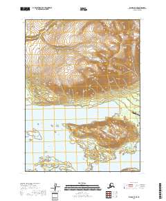
2018 Map of Iliamna D-4 SE
USGS Topo · Published 2018About this map
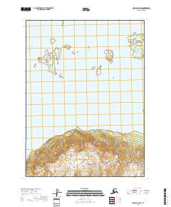
Iliamna Lake dominates the southern portion of this landscape, its shoreline deeply indented by Knutson Bay and Pedro Bay. This interior Alaskan region is defined by sharp topographic shifts where Knutson Mtn and Pedro Mtn rise abruptly from the water's edge. The small infrastructure footprint of the early 21st century is concentrated around the Pedro Bay Airport, connected by the short stretch of Airport Road near the mouth of Knutson Cr. Several islands, including Porcupine Island, Grassy Island, and Flat Island, are scattered across the lake, marking shoals and navigational points. The terrain transitions into the Knutson Valley, showing how glacial and fluvial processes like those of Canyon Cr have carved the high country in this Lake and Peninsula Borough territory.
Find a feature on this map
19 named features on this map. Tap any name to fly to it.
Don’t see what you’re looking for? This feature index may not catch every label — zoom into the map to look around manually.
Map Details
Editions of this 2018 Iliamna D-4 SE Map
This is the sole edition of this map. No revisions or reprints were ever made.
Other maps of this area

1952 · Iliamna
USGS Topo · 1:250,000

1954 · Iliamna D-3
USGS Topo · 1:63,360

1954 · Iliamna D-4
USGS Topo · 1:63,360

1954 · Iliamna C-3
USGS Topo · 1:63,360

1954 · Iliamna C-4
USGS Topo · 1:63,360

1957 · Iliamna
USGS Topo · 1:250,000
2018 · Iliamna C-4 NE
USGS Topo · 1:25,000
2018 · Iliamna D-4 SW
USGS Topo · 1:25,000
2018 · Iliamna C-3 NW
USGS Topo · 1:25,000
2018 · Iliamna C-4 NW
USGS Topo · 1:25,000