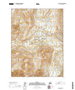
2019 Map of Iliamna D-7 NE
USGS Topo · Published 2019About this map
Upper Talarik Cr flows through the eastern portion of this remote Alaska landscape, which is defined by a dense network of countless small lakes and ponds. This 2019 survey documents the hydrologic patterns and topography of the Lake and Peninsula Borough just north of Lake Iliamna. The terrain is marked by significant contour transitions, with elevations rising from the water-rich lowlands in the north to the more defined ridges in the southern sections of the quadrangle. The map details the Public Land Survey System divisions, showing the junction of four townships including t2s r36w, t2s r35w, t3s r36w, and t3s r35w. This record is particularly useful for understanding the untouched wilderness and drainage patterns of the region before any major human development or infrastructure changed the natural character of the land.
Find a feature on this map
5 named features on this map. Tap any name to fly to it.
Don’t see what you’re looking for? This feature index may not catch every label — zoom into the map to look around manually.
Map Details
Editions of this 2019 Iliamna D-7 NE Map
This is the sole edition of this map. No revisions or reprints were ever made.
Other maps of this area

1946 · Lake Clark
USGS Topo · 1:250,000

1951 · Lake Clark
USGS Topo · 1:250,000

1952 · Iliamna
USGS Topo · 1:250,000

1954 · Lake Clark A-7
USGS Topo · 1:63,360

1954 · Lake Clark A-6
USGS Topo · 1:63,360

1954 · Iliamna D-7
USGS Topo · 1:63,360
1954 · Iliamna D-6
USGS Topo · 1:63,360

1957 · Iliamna
USGS Topo · 1:250,000

1958 · Lake Clark
USGS Topo · 1:250,000
2019 · Iliamna D-7 NW
USGS Topo · 1:25,000