
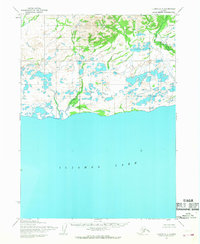
1954 Map of Iliamna D-7
USGS Topo · Published 1968About this map
The Koktuli River winds through this subarctic wilderness, carving a complex path through a landscape defined by glacial lakes and tundra. Surveyed in the mid-1950s using aerial photography, this region is dominated by the prominent peaks of Kashaiyak Mtn and Sharp Mtn, which rise above a network of unnamed streams and wetlands. The absence of roads or trails on this sheet emphasizes the remoteness of the terrain during the post-war era. Notably, the land lines shown represent unsurveyed locations predetermined by the Bureau of Land Management, reflecting the early stages of formal territorial organization before many of these areas were field-checked.
Find a feature on this map
3 named features on this map. Tap any name to fly to it.
Don’t see what you’re looking for? This feature index may not catch every label — zoom into the map to look around manually.
Map Details
Editions of this 1954 Iliamna D-7 Map
This is the sole edition of this map. No revisions or reprints were ever made.
Other maps of this area

1946 · Lake Clark
USGS Topo · 1:250,000

1951 · Lake Clark
USGS Topo · 1:250,000

1952 · Iliamna
USGS Topo · 1:250,000

1954 · Lake Clark A-7
USGS Topo · 1:63,360

1954 · Lake Clark A-8
USGS Topo · 1:63,360

1954 · Iliamna C-6
USGS Topo · 1:63,360

1954 · Iliamna C-8
USGS Topo · 1:63,360

1954 · Iliamna D-8
USGS Topo · 1:63,360

1954 · Lake Clark A-6
USGS Topo · 1:63,360
1954 · Iliamna C-7
USGS Topo · 1:63,360