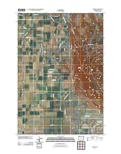
2011 Map of Imbler
USGS Topo · Published 2011About this map
Imbler serves as a central hub in this agricultural valley, where the town's grid is anchored by the Imbler Post Office and surrounded by a network of rural lanes including Imbler Rd and Hunt Ln. The landscape is defined by the meandering Grande Ronde River, which feeds a series of irrigation and storage systems such as the Ruckman Reservoir, Arnoldus Loop Reservoir, and Fleet Reservoir Number Two. To the east, the terrain rises sharply toward Mount Harris, while the western edge of the valley is guarded by the Blue Mountains.
Find a feature on this map
48 named features on this map. Tap any name to fly to it.
Don’t see what you’re looking for? This feature index may not catch every label — zoom into the map to look around manually.
Map Details
Editions of this 2011 Imbler Map
This is the sole edition of this map. No revisions or reprints were ever made.
Other maps of this area

1906 · Telocaset
USGS Topo · 1:125,000

1953 · Pendleton
USGS Topo · 1:250,000

1955 · Grangeville
USGS Topo · 1:250,000

1956 · Pendleton
USGS Topo · 1:250,000

1959 · Grangeville
USGS Topo · 1:250,000

1963 · La Grande SE
USGS Topo · 1:24,000

1963 · Sanderson Spring
USGS Topo · 1:24,000

1963 · Summerville
USGS Topo · 1:24,000

1964 · Cricket Flat
USGS Topo · 1:24,000

1964 · Elgin
USGS Topo · 1:24,000