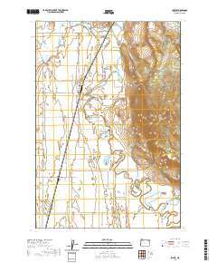
2020 Map of Imbler
USGS Topo · Published 2020About this map
Imbler and the surrounding agricultural lands of the Grande Ronde Valley are documented here, showing a landscape defined by water management and family farm roads. The path of the Grande Ronde River meanders through the eastern portion of the quadrangle, supplemented by an extensive system of irrigation and storage features including State Ditch, Fleets Loop Reservoir, and Bill Howell Reservoir. These waterworks supported the development of small rail-side communities and scattered homesteads across the valley floor.
Find a feature on this map
47 named features on this map. Tap any name to fly to it.
Don’t see what you’re looking for? This feature index may not catch every label — zoom into the map to look around manually.
Map Details
Editions of this 2020 Imbler Map
This is the sole edition of this map. No revisions or reprints were ever made.
Other maps of this area

1906 · Telocaset
USGS Topo · 1:125,000

1953 · Pendleton
USGS Topo · 1:250,000

1955 · Grangeville
USGS Topo · 1:250,000

1956 · Pendleton
USGS Topo · 1:250,000

1959 · Grangeville
USGS Topo · 1:250,000

1963 · La Grande SE
USGS Topo · 1:24,000

1963 · Sanderson Spring
USGS Topo · 1:24,000

1963 · Summerville
USGS Topo · 1:24,000

1964 · Cricket Flat
USGS Topo · 1:24,000

1964 · Elgin
USGS Topo · 1:24,000