
1973 Map of Imperial Municipal Airport
USGS Topo · Published 1977About this map
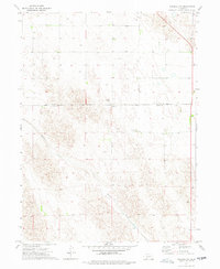
Imperial Municipal Airport anchors the southwestern corner of this Chase County landscape, reflecting the aviation development in the high plains during the early 1970s. The terrain is defined by the winding course of Spring Creek, which cuts diagonally across the eastern half of the survey area. Transport and logistics are central to the region's character, evidenced by the Burlington Northern railroad line running parallel to the southern boundary and the presence of the Smith Landing Strip (East) further east. The map identifies numerous locations of a Well, indicating the critical role of groundwater management for this agricultural stretch of Nebraska. This survey captures a moment when traditional rail transport and emerging aviation infrastructure coexisted to support the local economy.
Find a feature on this map
5 named features on this map. Tap any name to fly to it.
Don’t see what you’re looking for? This feature index may not catch every label — zoom into the map to look around manually.
Map Details
Editions of this 1973 Imperial Municipal Airport Map
This is the sole edition of this map. No revisions or reprints were ever made.
Other maps of this area

1954 · McCook
USGS Topo · 1:250,000

1957 · McCook
USGS Topo · 1:250,000

1958 · McCook
USGS Topo · 1:250,000

1973 · Champion
USGS Topo · 1:24,000

1973 · Imperial NE
USGS Topo · 1:24,000

1973 · Enders
USGS Topo · 1:24,000

1973 · Imperial
USGS Topo · 1:24,000

1973 · Dittons Creek NW
USGS Topo · 1:24,000
1973 · Imperial NW
USGS Topo · 1:24,000
1974 · Wauneta West
USGS Topo · 1:24,000