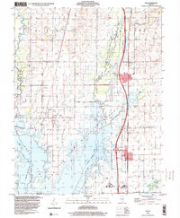
1998 Map of Ina
USGS Topo · Published 2000About this map
Ina and Bonnie anchor this late-1990s landscape, which is defined by the expansive waters of Rend Lake and its surrounding wildlife management areas. The map illustrates a region balanced between rural settlement and large-scale conservation, featuring the Rend Lake State Wildlife Refuge and the Rend Lake State Waterfowl Management Area along the Casey Fork. The presence of Rend Lake College south of town and the sprawling Wayne Fitzgerrell State Park highlights the area's role as a regional educational and recreational hub.
Find a feature on this map
36 named features on this map. Tap any name to fly to it.
Don’t see what you’re looking for? This feature index may not catch every label — zoom into the map to look around manually.
Map Details
Editions of this 1998 Ina Map
This is the sole edition of this map. No revisions or reprints were ever made.
Other maps of this area

1926 · Duquoin
USGS Topo · 1:62,500

1933 · Mount Vernon
USGS Topo · 1:48,000

1939 · Ina
USGS Topo · 1:62,500

1940 · Mount Vernon
USGS Topo · 1:62,500

1943 · Ina
USGS Topo · 1:62,500

1943 · Ashley
USGS Topo · 1:62,500

1946 · Ashley
USGS Topo · 1:62,500

1958 · Belleville
USGS Topo · 1:250,000

1962 · Belleville
USGS Topo · 1:250,000

1964 · Opdyke
USGS Topo · 1:24,000