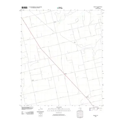
2010 Map of Inadale
USGS Topo · Published 2010About this map
Inadale and Wastella anchor this rural landscape in West Texas, where the local economy and movement were historically shaped by the rail line and the intermittent drainages of the Llano Estacado's edge. The presence of Pyron Siding along the tracks reflects the region's agricultural shipping history, providing a focal point for the surrounding ranches and farms. The terrain is etched by Buffalo Creek and Finn Creek, which create natural corridors through a grid of county roads that define the property boundaries and transport routes of Scurry County.
Find a feature on this map
43 named features on this map. Tap any name to fly to it.
Don’t see what you’re looking for? This feature index may not catch every label — zoom into the map to look around manually.
Map Details
Editions of this 2010 Inadale Map
This is the sole edition of this map. No revisions or reprints were ever made.
Other maps of this area

1952 · China Grove
USGS Topo · 1:24,000

1952 · Colorado City
USGS Topo · 1:24,000

1952 · Hermleigh
USGS Topo · 1:24,000

1954 · Big Spring
USGS Topo · 1:250,000

1958 · Big Spring
USGS Topo · 1:250,000

1969 · Bull Creek
USGS Topo · 1:24,000

1969 · Inadale NW
USGS Topo · 1:24,000

1969 · Loraine
USGS Topo · 1:24,000

1969 · Bernecker
USGS Topo · 1:24,000

1969 · Roscoe
USGS Topo · 1:24,000