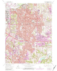
1964 Map of Independence
USGS Topo · Published 1983About this map
The Independence city center and its radiating suburbs define this mid-century survey, showcasing the hometown legacy of Harry S. Truman. The map documents the Truman Courthouse, the Truman Library, and the Truman Institute, anchoring the historic core amidst a rapidly expanding urban landscape. Transportation is a central theme, with the Blue River valley serving as a corridor for the Kansas City Terminal and Atchison Topeka and Santa Fe railroads, alongside major transit arteries like Truman Rd and Winner Rd.
Find a feature on this map
80 named features on this map. Tap any name to fly to it.
Don’t see what you’re looking for? This feature index may not catch every label — zoom into the map to look around manually.
Map Details
Editions of this 1964 Independence Map
4 editions found
Other maps of this area

1887 · Harrisonville
USGS Topo · 1:125,000

1887 · Olathe
USGS Topo · 1:125,000

1890 · Kansas City
USGS Topo · 1:125,000

1892 · Harrisonville
USGS Topo · 1:125,000

1893 · Olathe
USGS Topo · 1:125,000

1894 · Kansas City
USGS Topo · 1:125,000

1894 · Harrisonville
USGS Topo · 1:125,000

1894 · Independence
USGS Topo · 1:125,000

1933 · Blue Springs
USGS Topo · 1:24,000

1934 · Independence
USGS Topo · 1:24,000