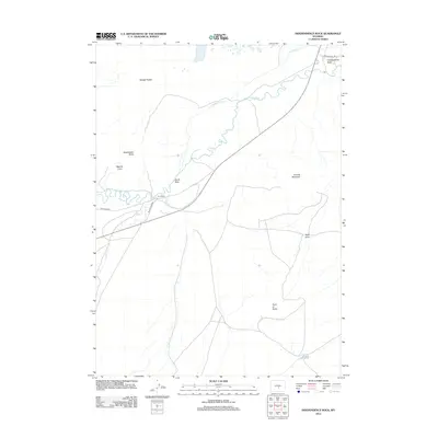
2012 Map of Independence Rock
USGS Topo · Published 2012About this map
Independence Rock stands as a primary landmark in this section of Natrona County, marking a site deeply connected to the westward migration era along the Oregon Trail Rd. The landscape is dominated by the meandering Sweetwater River, which passes through the narrow Devils Gate and flows near Martins Cove. This terrain, characterized by high-desert features like Granite Mountain and the Sweetwater Rocks, reflects a ranching and conservation history centered on sites like Sun Ranch. The presence of the Schounmaker Ditch highlights the importance of water management in this arid region, where small seasonal flows such as Rush Cr and Pete Cr drain the surrounding basins like Savage Pocket.
Find a feature on this map
17 named features on this map. Tap any name to fly to it.
Don’t see what you’re looking for? This feature index may not catch every label — zoom into the map to look around manually.
Map Details
Editions of this 2012 Independence Rock Map
This is the sole edition of this map. No revisions or reprints were ever made.
Other maps of this area

1951 · Savage Peak
USGS Topo · 1:24,000

1951 · Independence Rock
USGS Topo · 1:24,000

1951 · Fort Ridge
USGS Topo · 1:24,000

1953 · Buzzard Ranch
USGS Topo · 1:24,000

1953 · Spanish Mine
USGS Topo · 1:24,000

1955 · Casper
USGS Topo · 1:250,000

1958 · Casper
USGS Topo · 1:250,000

1959 · Sanford Ranch
USGS Topo · 1:24,000

1959 · Miller Spring
USGS Topo · 1:24,000
1959 · Beulah Belle Lake
USGS Topo · 1:24,000