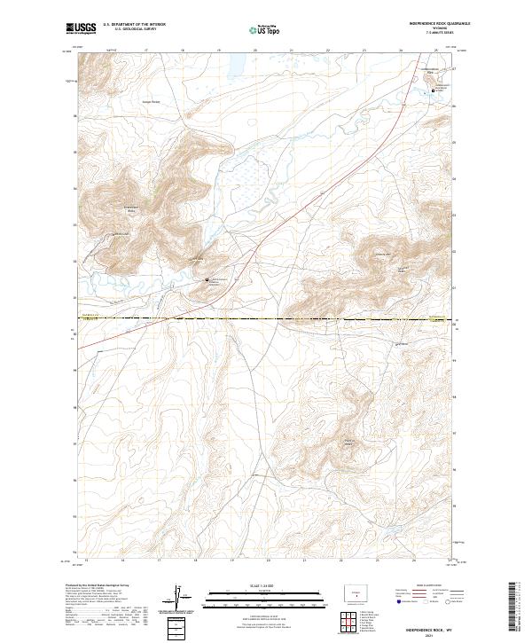
2021 Map of Independence Rock
USGS Topo · Published 2021About this map
Independence Rock stands as a primary landmark along the Sweetwater River, marking a storied corridor across the Wyoming landscape. This topographic record documents a place of immense significance to western migration, preserving the locations of the Independence Rock Burial Ground and the Frederick Richard Fulkerson Gravesite. The terrain is defined by dramatic granite formations including Devils Gate, Sentinel Rocks, and the Sweetwater Rocks, which flank the river valley.
Find a feature on this map
24 named features on this map. Tap any name to fly to it.
Don’t see what you’re looking for? This feature index may not catch every label — zoom into the map to look around manually.
Map Details
Editions of this 2021 Independence Rock Map
This is the sole edition of this map. No revisions or reprints were ever made.
Other maps of this area

1951 · Savage Peak
USGS Topo · 1:24,000

1951 · Independence Rock
USGS Topo · 1:24,000

1951 · Fort Ridge
USGS Topo · 1:24,000

1953 · Buzzard Ranch
USGS Topo · 1:24,000

1953 · Spanish Mine
USGS Topo · 1:24,000

1955 · Casper
USGS Topo · 1:250,000

1958 · Casper
USGS Topo · 1:250,000

1959 · Sanford Ranch
USGS Topo · 1:24,000

1959 · Miller Spring
USGS Topo · 1:24,000
1959 · Beulah Belle Lake
USGS Topo · 1:24,000