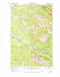
1957 Map of Index
USGS Topo · Published 1973About this map
Index and Gold Bar serve as the primary valley hubs in this mid-century survey of the Cascade foothills, where the Great Northern railroad follows the winding path of the Skykomish River. The map reveals a landscape defined by dramatic elevation changes and resource extraction, notably featuring the Lockwood Mine and several quarries. Water power is a central theme, evidenced by the Fish Hatchery near Startup and the series of spectacular cascades along the tributaries, including Wallace Falls, Sunset Falls, and Bridal Veil Falls. High above the river valleys, the Snoqualmie National Forest boundary encompasses massive peaks such as Mt Index and Mt Persis. The presence of the North Fork Guard Station and the Great Northern Railroad Grade near the Sultan River indicates the active management and industrial history of these timbered basins.
Find a feature on this map
80 named features on this map. Tap any name to fly to it.
Don’t see what you’re looking for? This feature index may not catch every label — zoom into the map to look around manually.
Map Details
Editions of this 1957 Index Map

Other maps of this area

1899 · Glacier Peak
USGS Topo · 1:125,000

1899 · Stillaguamish
USGS Topo · 1:125,000

1901 · Glacier Peak
USGS Topo · 1:125,000

1901 · Stilaguamish
USGS Topo · 1:125,000

1902 · Skykomish
USGS Topo · 1:125,000

1905 · Skykomish
USGS Topo · 1:125,000

1921 · Sultan
USGS Topo · 1:125,000

1923 · Sultan
USGS Topo · 1:125,000

1953 · Sultan
USGS Topo · 1:24,000

1953 · Lake Joy
USGS Topo · 1:24,000