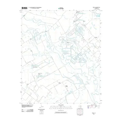
2010 Map of India
USGS Topo · Published 2010About this map
The Trinity River and its intricate network of sloughs and creeks dominate this 2010 survey of the area near India, Walnut Springs, and Combine. The landscape is defined by the expansive Bois D'Arc Island and the meandering path of Parsons Slough, indicating a floodplain environment managed by numerous water control structures such as the Soil Conservation Service Site 4 Dam and its associated reservoir. These engineering works reflect long-standing efforts to stabilize the river basin for agricultural and local use.
Find a feature on this map
67 named features on this map. Tap any name to fly to it.
Don’t see what you’re looking for? This feature index may not catch every label — zoom into the map to look around manually.
Map Details
Editions of this 2010 India Map
This is the sole edition of this map. No revisions or reprints were ever made.
Other maps of this area

1891 · Dallas
USGS Topo · 1:125,000

1893 · Dallas
USGS Topo · 1:125,000

1954 · Dallas
USGS Topo · 1:250,000

1956 · Ennis
USGS Topo · 1:62,500

1956 · Kaufman
USGS Topo · 1:62,500

1958 · Dallas
USGS Topo · 1:250,000

1958 · Hutchins
USGS Topo · 1:24,000

1959 · Seagoville
USGS Topo · 1:24,000

1959 · Ferris
USGS Topo · 1:24,000

1959 · India
USGS Topo · 1:24,000