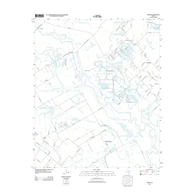
2012 Map of India
USGS Topo · Published 2012About this map
India and Walnut Springs anchor the southwestern landscape of this 2012 survey, where the low-lying bottomlands of the Trinity River meet the rising prairie. The map captures a complex hydrological network defined by Parsons Slough, Gravel Slough, and the meandering courses of Tenmile Cr and Old Tenmile Cr. These waterways historically isolated the land, leading to the formation of Bois D'Arc Island and the placement of critical river crossings like Wilmer Bridge and Malloy Bridge.
Find a feature on this map
91 named features on this map. Tap any name to fly to it.
Don’t see what you’re looking for? This feature index may not catch every label — zoom into the map to look around manually.
Map Details
Editions of this 2012 India Map
This is the sole edition of this map. No revisions or reprints were ever made.
Other maps of this area

1891 · Dallas
USGS Topo · 1:125,000

1893 · Dallas
USGS Topo · 1:125,000

1954 · Dallas
USGS Topo · 1:250,000

1956 · Ennis
USGS Topo · 1:62,500

1956 · Kaufman
USGS Topo · 1:62,500

1958 · Dallas
USGS Topo · 1:250,000

1958 · Hutchins
USGS Topo · 1:24,000

1959 · Seagoville
USGS Topo · 1:24,000

1959 · Ferris
USGS Topo · 1:24,000

1959 · India
USGS Topo · 1:24,000