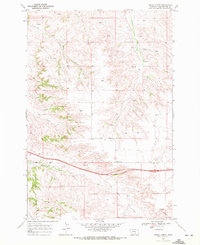
1969 Map of Indian Arrow
USGS Topo · Published 1972About this map
Indian Base Line serves as a primary geographic anchor for this 1969 survey of Yellowstone County, Montana. The terrain is defined by an intricate network of drainage systems, including Arrow Creek, Indian Creek, and Telegraph Creek, which carve through the landscape south of the Crow Indian Reservation Boundary. Evidence of mid-century infrastructure and land use is visible in the isolated Oil Well and a small Landing Strip, while the prominent Huntley benchmark sits atop a high ridge overlooking Burnt Coulee. This survey was conducted just as photogrammetric methods were being refined, capturing the winding paths of Squaw Creek Road and Indian Creek Road before modern development altered these rural corridors. The map provides a detailed view of the transitional topography between the plateaus and the deep coulees such as Custer Coulee and Three Wolf Creek.
Find a feature on this map
20 named features on this map. Tap any name to fly to it.
Don’t see what you’re looking for? This feature index may not catch every label — zoom into the map to look around manually.
Map Details
Editions of this 1969 Indian Arrow Map
2 editions found
Other maps of this area

1893 · Huntley
USGS Topo · 1:125,000

1954 · Billings
USGS Topo · 1:250,000

1956 · Huntley
USGS Topo · 1:24,000

1957 · Billings
USGS Topo · 1:250,000

1958 · Billings
USGS Topo · 1:250,000

1967 · Nibbe
USGS Topo · 1:24,000

1967 · Worden
USGS Topo · 1:24,000

1967 · Cottonwood Creek
USGS Topo · 1:24,000
1967 · Badbaby Coulee
USGS Topo · 1:24,000
1969 · Woody Mountain NW
USGS Topo · 1:24,000