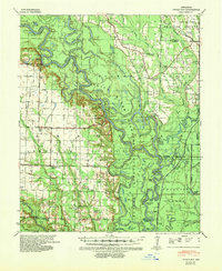
1939 Map of Indian Bay
USGS Topo · Published 1942About this map
The White River carves a winding path through this corner of Arkansas, defining the landscape and the boundary between Monroe and Phillips counties. Within the expansive White River Migratory Waterfowl Refuge, the river's complex hydrology is visible through numerous oxbows and cut-offs like Anderson Cut-off and Sinking Bay. This area represents a critical wetland environment before mid-century modifications significantly altered many of the nation's river systems.
Find a feature on this map
56 named features on this map. Tap any name to fly to it.
Don’t see what you’re looking for? This feature index may not catch every label — zoom into the map to look around manually.
Map Details
Editions of this 1939 Indian Bay Map
2 editions found
Other maps of this area

1930 · Mellwood
USGS Topo · 1:62,500

1935 · Clarendon
USGS Topo · 1:62,500

1935 · Gillett
USGS Topo · 1:62,500

1939 · Modoc
USGS Topo · 1:62,500

1939 · Indian Bay
USGS Topo · 1:62,500

1939 · Henrico
USGS Topo · 1:62,500

1939 · Mellwood
USGS Topo · 1:62,500

1940 · Marvell
USGS Topo · 1:62,500

1940 · Holly Grove
USGS Topo · 1:62,500

1941 · De Witt
USGS Topo · 1:62,500