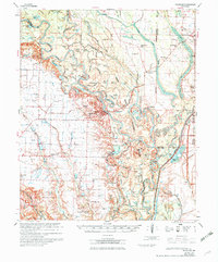
1970 Map of Indian Bay
USGS Topo · Published 1970About this map
The White River National Wildlife Refuge dominates this riverine landscape, where the meandering White River carves a complex network of oxbows and sloughs. Small settlements like St Charles, Crocketts Bluff, and Turner are established on the higher ground flanking the bottomlands. The map reveals a deep human history of the region, from the ancient Indian Mound near the river to the scattered country parishes of the 1960s, including Hill Chapel, St Mathew Ch, and New Hope Ch. The land is defined by water, with dozens of named lakes such as Horseshoe Lake, Upper Hooked Lake, and Goose Lake filling the floodplains. This survey records a period of agricultural drainage and flood control, evidenced by the intricate system of siphons and flumes surrounding Hopewell Sch and the Lutheran Cem.
Find a feature on this map
88 named features on this map. Tap any name to fly to it.
Don’t see what you’re looking for? This feature index may not catch every label — zoom into the map to look around manually.
Map Details
Editions of this 1970 Indian Bay Map
2 editions found
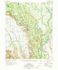
Other maps of this area

1930 · Mellwood
USGS Topo · 1:62,500

1935 · Clarendon
USGS Topo · 1:62,500

1935 · Gillett
USGS Topo · 1:62,500

1939 · Modoc
USGS Topo · 1:62,500

1939 · Indian Bay
USGS Topo · 1:62,500

1939 · Henrico
USGS Topo · 1:62,500

1939 · Mellwood
USGS Topo · 1:62,500

1940 · Marvell
USGS Topo · 1:62,500

1940 · Holly Grove
USGS Topo · 1:62,500

1941 · De Witt
USGS Topo · 1:62,500