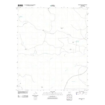
2010 Map of Indian Bluff
USGS Topo · Published 2010About this map
Rio Felix and Walnut Creek meander through this New Mexico landscape, defining a region where water sources were critical to high-desert ranching. The topographic data reveals a network of canyons including Monument Canyon, Dark Canyon, and Cedar Canyon that carve through the arid terrain. Settlement patterns are sparse, represented by isolated outposts such as McGee Ranch, Waller Ranch, and Twin Butte Camp. These remote locations were historically linked by primitive routes like Twin Butte Canyon Rd and Squaw Canyon Rd. The importance of water management in this environment is emphasized by the mapping of specific features like the Indian Bluff Water Hole and Gressett Water Hole, which served as vital landmarks for livestock and local residents near Indian Bluff.
Find a feature on this map
16 named features on this map. Tap any name to fly to it.
Don’t see what you’re looking for? This feature index may not catch every label — zoom into the map to look around manually.
Map Details
Editions of this 2010 Indian Bluff Map
This is the sole edition of this map. No revisions or reprints were ever made.
Other maps of this area

1949 · Juan Lake
USGS Topo · 1:24,000

1954 · Carlsbad
USGS Topo · 1:250,000

1955 · Hope NW
USGS Topo · 1:24,000

1955 · Kincaid Ranch
USGS Topo · 1:24,000

1955 · Roswell
USGS Topo · 1:250,000

1958 · Carlsbad
USGS Topo · 1:250,000

1958 · Roswell
USGS Topo · 1:250,000

1960 · Teel Ranch
USGS Topo · 1:62,500

1961 · Indian Bluff
USGS Topo · 1:62,500

1962 · Roswell
USGS Topo · 1:250,000