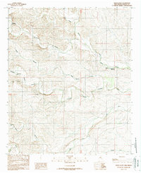
1989 Map of Indian Bluff
USGS Topo · Published 1989About this map
Indian Bluff stands as a prominent terrain feature in this 1980s landscape of southeastern New Mexico, where the availability of water dictated the patterns of ranching and settlement. The land is marked by an extensive network of drainages and named canyons, including Monument Canyon and Twin Butte Canyon, which converge toward the Rio Felix in the southern portion of the quadrangle. Human activity is concentrated around essential water sources such as Gressett Water Hole, Indian Bluff Water Hole, and numerous improved sites like Crooked Creek Well and Horse Canyon Well. The presence of the Kincaid Ranch and Twin Butte Camp reflects the region's enduring pastoral economy. A Gravel Pit near Walnut Draw indicates localized industrial activity amidst the vast system of ephemeral creeks and dry canyons.
Find a feature on this map
22 named features on this map. Tap any name to fly to it.
Don’t see what you’re looking for? This feature index may not catch every label — zoom into the map to look around manually.
Map Details
Editions of this 1989 Indian Bluff Map
This is the sole edition of this map. No revisions or reprints were ever made.
Other maps of this area

1949 · Juan Lake
USGS Topo · 1:24,000

1954 · Carlsbad
USGS Topo · 1:250,000

1955 · Hope NW
USGS Topo · 1:24,000

1955 · Kincaid Ranch
USGS Topo · 1:24,000

1955 · Roswell
USGS Topo · 1:250,000

1958 · Carlsbad
USGS Topo · 1:250,000

1958 · Roswell
USGS Topo · 1:250,000

1960 · Teel Ranch
USGS Topo · 1:62,500

1961 · Indian Bluff
USGS Topo · 1:62,500

1962 · Roswell
USGS Topo · 1:250,000