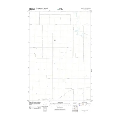
2011 Map of Indian Butte
USGS Topo · Published 2011About this map
Indian Butte rises as a prominent landmark in this section of Stark County, defining a landscape primarily shaped by the section-line grid of rural North Dakota. The Branch Knife River meanders across the northeastern portion of the sheet, providing a natural break in the orderly arrangement of agricultural roads and section boundaries. This area, mapped in the early 21st century, shows a highly organized transport network consisting of numerous numbered routes such as 83rd Ave SW and 30th St Sw. The southern edge of the map is intersected by County Rd 139, a significant arterial road for the region. The map reflects the enduring prairie geography where topography like the butte remains a central point of orientation amidst the expansive network of farm-to-market roads.
Find a feature on this map
21 named features on this map. Tap any name to fly to it.
Don’t see what you’re looking for? This feature index may not catch every label — zoom into the map to look around manually.
Map Details
Editions of this 2011 Indian Butte Map
This is the sole edition of this map. No revisions or reprints were ever made.
Other maps of this area

1953 · Dickinson
USGS Topo · 1:250,000

1953 · Watford City
USGS Topo · 1:250,000

1957 · Dickinson
USGS Topo · 1:250,000

1957 · Watford City
USGS Topo · 1:250,000

1967 · Watford City
USGS Topo · 1:250,000
1973 · Hebron SE
USGS Topo · 1:24,000

1973 · Marshall SE
USGS Topo · 1:24,000
1973 · Hebron
USGS Topo · 1:24,000

1973 · Willow Creek West
USGS Topo · 1:24,000
1973 · Willow Creek East
USGS Topo · 1:24,000