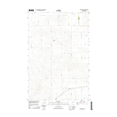
2014 Map of Indian Butte
USGS Topo · Published 2014About this map
Indian Butte stands as the central topographic landmark in this section of the North Dakota plains, marking the high ground between the southern drainage of Highway 10 and the north-flowing waters of the Br Knife River. The landscape is defined by a rigid section-line grid of rural roads, including 85th Ave SW and 29th St SW, which trace the agricultural boundaries across the Stark Co and Mercer Co border. The presence of Highway 10 in the southern portion of the map indicates a primary corridor for travel across this prairie terrain, while the winding path of the river branch contrasts with the geometric precision of the surrounding county roads. This survey illustrates the sparse, late-modern settlement patterns of the region, where land usage is largely dictated by the sprawling topography of the butte and the natural flow of the local river systems.
Find a feature on this map
21 named features on this map. Tap any name to fly to it.
Don’t see what you’re looking for? This feature index may not catch every label — zoom into the map to look around manually.
Map Details
Editions of this 2014 Indian Butte Map
This is the sole edition of this map. No revisions or reprints were ever made.
Other maps of this area
1953 · Dickinson
USGS Topo · 1:250,000
1953 · Watford City
USGS Topo · 1:250,000
1957 · Dickinson
USGS Topo · 1:250,000
1957 · Watford City
USGS Topo · 1:250,000
1967 · Watford City
USGS Topo · 1:250,000
1973 · Hebron SE
USGS Topo · 1:24,000
1973 · Marshall SE
USGS Topo · 1:24,000
1973 · Hebron
USGS Topo · 1:24,000
1973 · Willow Creek West
USGS Topo · 1:24,000
1973 · Willow Creek East
USGS Topo · 1:24,000