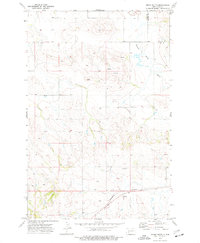
1973 Map of Indian Butte
USGS Topo · Published 1977About this map
Indian Butte rises as a prominent landmark in this upland landscape where the Mercer Co Stark Co boundary bisects the northern plains of western North Dakota. The drainage patterns are defined by the winding course of the Knife River and its tributary, the Branch Knife River, which cut through the open country. This survey reflects a mid-1970s view of the region's infrastructure, dominated in the south by the Burlington Northern railroad corridor. While the terrain is largely undeveloped ranch or farmland, the presence of numerous wells and a small Gravel Pit indicate the local extraction activities and water management essential for survival in this arid environment.
Find a feature on this map
9 named features on this map. Tap any name to fly to it.
Don’t see what you’re looking for? This feature index may not catch every label — zoom into the map to look around manually.
Map Details
Editions of this 1973 Indian Butte Map
This is the sole edition of this map. No revisions or reprints were ever made.
Other maps of this area

1953 · Dickinson
USGS Topo · 1:250,000

1953 · Watford City
USGS Topo · 1:250,000

1957 · Dickinson
USGS Topo · 1:250,000

1957 · Watford City
USGS Topo · 1:250,000

1967 · Watford City
USGS Topo · 1:250,000
1973 · Hebron SE
USGS Topo · 1:24,000

1973 · Marshall SE
USGS Topo · 1:24,000
1973 · Hebron
USGS Topo · 1:24,000

1973 · Willow Creek West
USGS Topo · 1:24,000
1973 · Willow Creek East
USGS Topo · 1:24,000