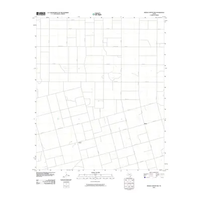
2010 Map of Indian Canyon NW
USGS Topo · Published 2010About this map
Plain View Cemetery sits as a central historical marker in this agricultural landscape near the community of Plains. The area is defined by a rigorous grid of section-line roads, such as Co RD 35 and Co RD Ee, which partition the West Texas terrain into expansive farm and ranch tracts. This 2010 survey illustrates the transition from earlier gravel county routes to more permanent infrastructure, including Ranch Rd 2053 and Fm 1054. The settlement pattern around Plains remains sparse, with the map recording the precise location of isolated dwellings and agricultural structures that supported the local ranching economy. The orientation of the road network, including the diagonal path of Ranch Rd 1210, reflects the historical property boundaries and land use requirements of this Borden County region.
Find a feature on this map
32 named features on this map. Tap any name to fly to it.
Don’t see what you’re looking for? This feature index may not catch every label — zoom into the map to look around manually.
Map Details
Editions of this 2010 Indian Canyon NW Map
This is the sole edition of this map. No revisions or reprints were ever made.
Other maps of this area

1954 · Lubbock
USGS Topo · 1:250,000

1954 · Big Spring
USGS Topo · 1:250,000

1958 · Big Spring
USGS Topo · 1:250,000

1968 · Hancock
USGS Topo · 1:24,000

1969 · Skeen Lake
USGS Topo · 1:24,000

1969 · O'Donnell
USGS Topo · 1:24,000

1969 · Indian Canyon NE
USGS Topo · 1:24,000

1969 · Indian Canyon
USGS Topo · 1:24,000

1969 · Grassland SE
USGS Topo · 1:24,000

1969 · Holloway Canyon
USGS Topo · 1:24,000