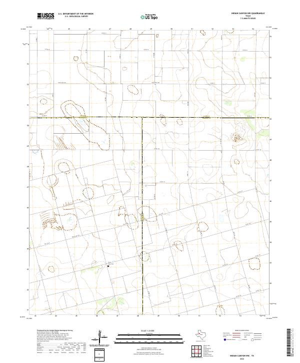
2022 Map of Indian Canyon NW
USGS Topo · Published 2022About this map
Three Texas counties converge in this agricultural landscape of the South Plains, where Lynn, Dawson, and Borden counties meet. The terrain is defined by a grid of county roads and ranch-to-market routes like Ranch Rd 2053 and Fm 1054, facilitating movement through this sprawling ranchland. A significant landmark for local history researchers is the Plain View Cem, located in the southwest quadrant near the Dawson and Borden county line. The map illustrates a high concentration of ephemeral wetlands and depressions typical of the Llano Estacado, interspersed between large-scale land plots and access roads like Co Rd 38 and Co Rd 145. This network of infrastructure underscores the area's ongoing dedication to ranching and dryland farming well into the twenty-first century.
Find a feature on this map
36 named features on this map. Tap any name to fly to it.
Don’t see what you’re looking for? This feature index may not catch every label — zoom into the map to look around manually.
Map Details
Editions of this 2022 Indian Canyon NW Map
This is the sole edition of this map. No revisions or reprints were ever made.
Other maps of this area

1954 · Lubbock
USGS Topo · 1:250,000

1954 · Big Spring
USGS Topo · 1:250,000

1958 · Big Spring
USGS Topo · 1:250,000

1968 · Hancock
USGS Topo · 1:24,000

1969 · Skeen Lake
USGS Topo · 1:24,000

1969 · O'Donnell
USGS Topo · 1:24,000

1969 · Indian Canyon NE
USGS Topo · 1:24,000

1969 · Indian Canyon
USGS Topo · 1:24,000

1969 · Grassland SE
USGS Topo · 1:24,000

1969 · Holloway Canyon
USGS Topo · 1:24,000