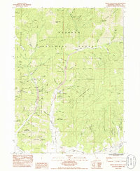
1984 Map of Indian Creek Baldy
USGS Topo · Published 1986About this map
The gold-mining legacy of the Klamath Mountains is etched into the landscape of this mid-1980s survey, where extensive dredge tailings and McAdam tailings follow the path of McAdam Creek Road. The map documents a geography of memory, specifically noting the locations of former settlements at Hooperville and Deadwood. A historical monument near the site of Deadwood further emphasizes the cultural importance of these nineteenth-century mining hubs.
Find a feature on this map
85 named features on this map. Tap any name to fly to it.
Don’t see what you’re looking for? This feature index may not catch every label — zoom into the map to look around manually.
Map Details
Editions of this 1984 Indian Creek Baldy Map
2 editions found
Other maps of this area

1886 · Shasta
USGS Topo · 1:250,000

1894 · Shasta
USGS Topo · 1:250,000

1932 · Yreka
USGS Topo · 1:96,000

1939 · Yreka
USGS Topo · 1:125,000

1948 · Weed
USGS Topo · 1:250,000

1950 · Weed
USGS Topo · 1:250,000

1954 · Yreka
USGS Topo · 1:62,500

1955 · Condrey Mtn
USGS Topo · 1:62,500
1955 · Hornbrook
USGS Topo · 1:62,500
1955 · Fort Jones
USGS Topo · 1:62,500