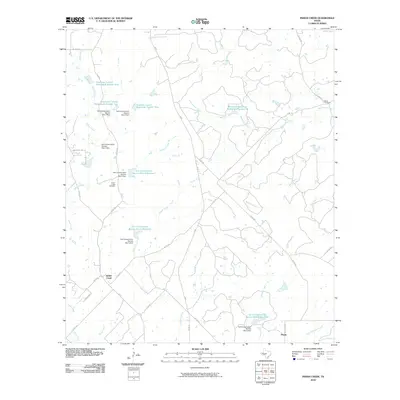
2010 Map of Indian Creek
USGS Topo · Published 2010About this map
Indian Creek and the small community of Ebony anchor this central Texas landscape, characterized by an extensive system of watershed management and agricultural infrastructure. The territory is defined by the numerous Soil Conservation Service projects, including the Soil Conservation Service Site 4 Reservoir and Soil Conservation Service Site 5 Reservoir, which demonstrate the mid-to-late 20th-century efforts to stabilize the regional hydrology. Local history and genealogy are preserved at the Indian Creek Cemetery and Elkins Cemetery, located near the northern reaches of Mackinally Creek. The drainage pattern is complex, with Buffalo Creek, Rough Creek, and Terrapin Creek all feeding the larger basin. Transportation follows a network of rural routes such as FM 45 and FM 586, connecting these dispersed settlements through the ranching and farming country of Brown County.
Find a feature on this map
46 named features on this map. Tap any name to fly to it.
Don’t see what you’re looking for? This feature index may not catch every label — zoom into the map to look around manually.
Map Details
Editions of this 2010 Indian Creek Map
This is the sole edition of this map. No revisions or reprints were ever made.
Other maps of this area

1885 · San Saba
USGS Topo · 1:125,000

1887 · Coleman
USGS Topo · 1:125,000

1889 · Brownwood
USGS Topo · 1:125,000

1889 · Coleman
USGS Topo · 1:125,000

1894 · Brady
USGS Topo · 1:125,000

1894 · Brownwood
USGS Topo · 1:125,000

1894 · San Saba
USGS Topo · 1:125,000

1925 · Brownwood 3-b
USGS Topo · 1:48,000

1925 · San Saba 2-a
USGS Topo · 1:48,000

1925 · Brady 1-a
USGS Topo · 1:48,000