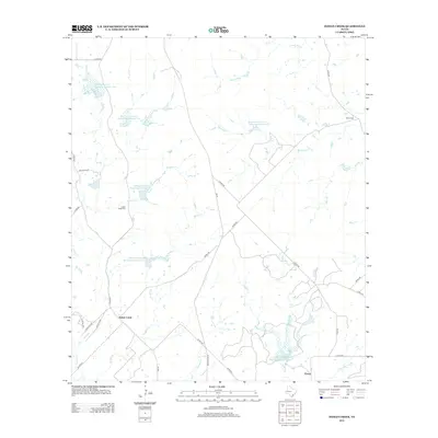
2012 Map of Indian Creek
USGS Topo · Published 2012About this map
Indian Creek and the small settlement of Ebony anchor this central Texas landscape, characterized by an extensive network of managed watersheds and seasonal creeks. The terrain is defined by engineered water management systems such as the Northeast Lateral Watershed Number One and the Soil Conservation Service Site 6 Reservoir, illustrating the mid-century transition toward soil and water conservation in the region. Branching outward from the Devils River, several tributaries like Mackinally Creek and Buffalo Creek cut through the countryside, while local history is preserved at the Indian Creek Cemetery and Elkins Cemetery. The map details a web of rural routes including FM 45 and Ranch Road 45, which connect these isolated homesteads and agricultural tracts.
Find a feature on this map
42 named features on this map. Tap any name to fly to it.
Don’t see what you’re looking for? This feature index may not catch every label — zoom into the map to look around manually.
Map Details
Editions of this 2012 Indian Creek Map
This is the sole edition of this map. No revisions or reprints were ever made.
Other maps of this area

1885 · San Saba
USGS Topo · 1:125,000

1887 · Coleman
USGS Topo · 1:125,000

1889 · Brownwood
USGS Topo · 1:125,000

1889 · Coleman
USGS Topo · 1:125,000

1894 · Brady
USGS Topo · 1:125,000

1894 · Brownwood
USGS Topo · 1:125,000

1894 · San Saba
USGS Topo · 1:125,000

1925 · Brownwood 3-b
USGS Topo · 1:48,000

1925 · San Saba 2-a
USGS Topo · 1:48,000

1925 · Brady 1-a
USGS Topo · 1:48,000