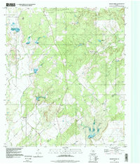
1997 Map of Indian Creek
USGS Topo · Published 1998About this map
The Camp Bowie Military Reservation dominates the northern reaches of this landscape, marking a significant military presence in the region. To the south, the small community of Indian Creek serves as a focal point for local history, situated near the winding waters of its namesake stream. The terrain is defined by an intricate network of drainages, including Terrapin Creek, Mackinally Creek, and Buffalo Creek, which carve through the countryside toward the Brown and Mills County line.
Find a feature on this map
19 named features on this map. Tap any name to fly to it.
Don’t see what you’re looking for? This feature index may not catch every label — zoom into the map to look around manually.
Map Details
Editions of this 1997 Indian Creek Map
This is the sole edition of this map. No revisions or reprints were ever made.
Other maps of this area

1885 · San Saba
USGS Topo · 1:125,000

1887 · Coleman
USGS Topo · 1:125,000

1889 · Brownwood
USGS Topo · 1:125,000

1889 · Coleman
USGS Topo · 1:125,000

1894 · Brady
USGS Topo · 1:125,000

1894 · Brownwood
USGS Topo · 1:125,000

1894 · San Saba
USGS Topo · 1:125,000

1925 · Brownwood 3-b
USGS Topo · 1:48,000

1925 · San Saba 2-a
USGS Topo · 1:48,000

1925 · Brady 1-a
USGS Topo · 1:48,000