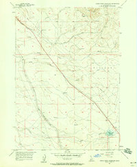
1957 Map of Indian Creek Reservoir
USGS Topo · Published 1958About this map
Route of Oregon Trail traces a historic path through this Idaho landscape, passing directly by Bonneville Point in the northeast. The terrain is defined by a network of drainage systems including Blacks Creek, Bryans Run, and Slaters Run which lead toward the expansive Slaters Flat. Modern infrastructure of the late 1950s is superimposed over these older trails, most notably the Union Pacific (Oregon Short Line) railroad and a series of utilitarian features like a Microwave Relay Station and various sections of Pipeline and Ditch lines.
Find a feature on this map
22 named features on this map. Tap any name to fly to it.
Don’t see what you’re looking for? This feature index may not catch every label — zoom into the map to look around manually.
Map Details
Editions of this 1957 Indian Creek Reservoir Map
2 editions found
Other maps of this area

1892 · Mountain Home
USGS Topo · 1:125,000

1892 · Boise
USGS Topo · 1:125,000

1892 · Bisuka
USGS Topo · 1:125,000

1893 · Mountain Home
USGS Topo · 1:125,000

1894 · Bisuka
USGS Topo · 1:125,000

1894 · Idaho Basin
USGS Topo · 1:125,000

1897 · Boise
USGS Topo · 1:125,000

1954 · Boise South
USGS Topo · 1:24,000

1954 · Boise
USGS Topo · 1:62,500

1955 · Christmas Mtn
USGS Topo · 1:24,000