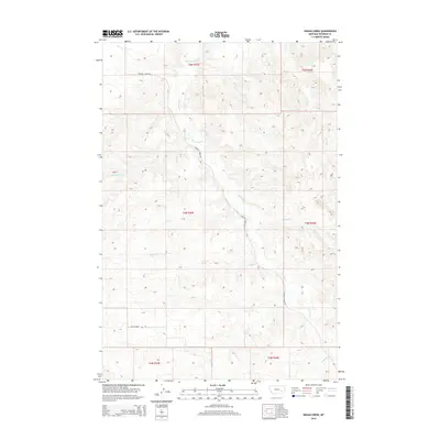
2014 Map of Indian Creek
USGS Topo · Published 2014About this map
Indian Cr and its tributaries carve a network of drainages through this section of Rosebud County, Montana. The landscape is defined by the steady progression of north-flowing watercourses, including Sweeney Cr and Buffalo Cr, which cut through the high plains. Human presence is marked primarily by isolated ranch roads like Sweeney Creek Rd and Butte Creek Rd, which follow the natural contours of the stream valleys. This 2014 survey reveals a sparsely settled region organized by the Public Land Survey System, with township and range lines like t5n r43e and t5n r44e providing the geometric structure for this rural Montana terrain. The map serves as a clear record of the area's hydrology, showing how minor drainages such as Runaway Cr and Coal Cr feed into the larger creek systems.
Find a feature on this map
14 named features on this map. Tap any name to fly to it.
Don’t see what you’re looking for? This feature index may not catch every label — zoom into the map to look around manually.
Map Details
Editions of this 2014 Indian Creek Map
This is the sole edition of this map. No revisions or reprints were ever made.
Other maps of this area

1954 · Forsyth
USGS Topo · 1:250,000

1957 · Forsyth
USGS Topo · 1:250,000

1958 · Forsyth
USGS Topo · 1:250,000
1968 · Rosebud
USGS Topo · 1:24,000
1968 · Hathaway
USGS Topo · 1:24,000
1968 · Thurlow
USGS Topo · 1:24,000
1969 · Miller Creek SW
USGS Topo · 1:24,000
1969 · Miller Creek NW
USGS Topo · 1:24,000
1971 · Indian Creek
USGS Topo · 1:24,000
1971 · Crain Place
USGS Topo · 1:24,000