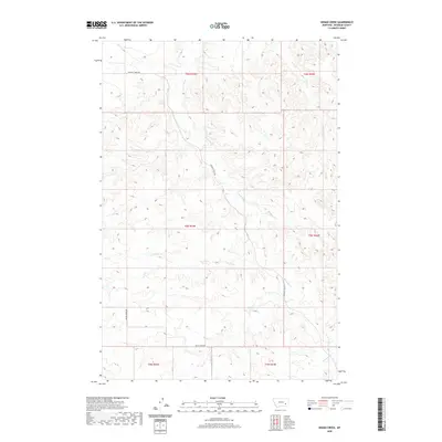
2020 Map of Indian Creek
USGS Topo · Published 2020About this map
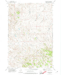
Indian Cr and its many tributaries carve a complex drainage pattern through this high plains landscape of Rosebud County. The terrain is defined by the hydrologic network of Sweeney Cr, Buffalo Cr, and Runaway Cr, which flow through various townships including t6n r43e and t5n r44e. Human infrastructure is sparse and largely confined to established travel corridors such as Sweeney Creek Rd and Butte Creek Rd, which provide access through the undulating sections of the prairie. The map captures the area as it appeared in the early 21st century, showing how modern land management and public land survey boundaries intersect with the natural flow of water bodies like Twelvemile Cr and Coal Cr. This is a landscape where geography is dictated by the slow erosion of coulees and the seasonal movement of water across the Montana range.
Find a feature on this map
14 named features on this map. Tap any name to fly to it.
Don’t see what you’re looking for? This feature index may not catch every label — zoom into the map to look around manually.
Map Details
Editions of this 2020 Indian Creek Map
This is the sole edition of this map. No revisions or reprints were ever made.
Other maps of this area

1954 · Forsyth
USGS Topo · 1:250,000

1957 · Forsyth
USGS Topo · 1:250,000

1958 · Forsyth
USGS Topo · 1:250,000

1968 · Rosebud
USGS Topo · 1:24,000

1968 · Hathaway
USGS Topo · 1:24,000

1968 · Thurlow
USGS Topo · 1:24,000
1969 · Miller Creek SW
USGS Topo · 1:24,000
1969 · Miller Creek NW
USGS Topo · 1:24,000
1971 · Indian Creek
USGS Topo · 1:24,000
1971 · Crain Place
USGS Topo · 1:24,000